|
|
Icon Configuration |
|
|
|
|
Icon Configuration |
|
|
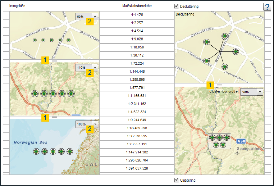
In the "Icon configuration" tab, you can create three different icon sizes for different scale ranges and set the display options Decluttering and Clustering.
Drag the white slider (1) to set the scale ranges and icon sizes to the corresponding scale and set to what percentage size (2) of the icon for the enclosed scale range.
Clusters prevent the overlapping of point object icons and ensure a nicer map image. When a cluster is clicked within the map application, the map enlarges to the section at this position and finally dissolves the points to individual symbols when either the distance of the icons to one another is large enough to avoid overlaps or the maximum cluster-scale is reached. If, furthermore, a cluster appears, you can click again on the cluster object and zoom the map.
Decluttering is a function that pulls individual point features apart to avoid overlapping. The symbols are referenced with lines. This ensures a legible map display with high feature density.
With the checkboxes "decluttering" and "clustering" you can easily enable or disable these functions. The scale level which should be used for decluttering or clustering can be set using the slider on the right side (1).