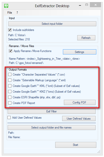
Under "Output format" you can select to which formats the scanned photos are exported.

Five different formats are available:
Character-Separated-Values - File (*.csv):
CSV-files permit the integration of your data into Microsoft Excel or into databases.
Extensible Markup Language (*.xml):
The in importance gaining XML-format offers a platform-wide integration of photos within your projects.
Google Earth Keyhole-Markup-Language (*.kml):
KML-files are the exchange format of the software Google Earth.
Use this format to illustrate your images in Google Earth.
The KML-file may also be used to plan a route with Google Maps. The route may then be downloaded and used in a mapping programme or in a GPS receiver.
Google Earth KMZ (*.kmz):
The KMZ-format is a compressed KML-file in ZIP format. In the KMZ-file, additionally, the photographs are stored so that this format is especially appropriate for sharing your projects.
ESRI Shapefile (*.shp + *.shx + *.dbf + *.prj):
Beside the SHP-file the SHX-, DBF- and PRJ-files are generated.
The format offers the possibility to integrate the image location as a point layer in shapefile-compatible geographic information systems. The name and paths of the associated photos are stored in the attribute table.
Portable Document Format (*.pdf) :
The PDF format can be illustrated and printed with Acrobat Reader and other illustration programs. Beside text and vector graphics, it may contain images. For more information on PDF export, please refer to section PDF Export.