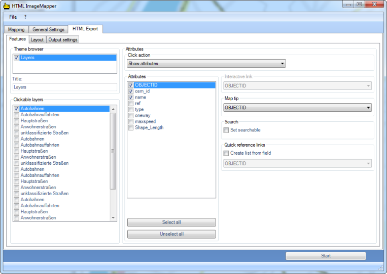
Theme browser
In the theme browser, the data frames of the ArcGIS project are at your disposition. If several data frames are chosen, an HTML ImageMapper 14.0 project is created, in which various thematic maps can be displayed.
It thus becomes possible, for instance, to switch between aerial photographs and topographical maps, like it is known from Google Maps. For each theme, the parameters of the layers can be set separately by choosing it from the list first.
Remark that all data frames have to be in the same coordinate system.
Clickable layers
All the layers are listed here.
If you put a checkmark next to one of the layers, you can set the options and actions which are available for this layer in the “Layer” box.
Layer options
For every layer, the following options exist:
- Map tip:
Here you can select the attribute field to be displayed when the mouse cursor is positioned over an object in this layer.
- Search:
This option is only available if the click action is set to "Show attributes".
This activates the search function for the active layer. Only the attribute fields selected in the “Attributes” list can be searched.
- Quick reference links:
This option is only available if the click action is set to "Show attributes".
Here you can have a list created for a user-defined attribute field. The elements of this list can be clicked, making the map navigate to the corresponding object.
Click functions Features
The pulldown menu “Click functions” allows you to select the action which is carried out when clicking on an object in the browser.
The following options are available:
- Show attributes:
If you choose this option, a table with attribute data is displayed when clicking on an object. You can choose the attribute fields to be used from the list “Attributes”. Besides, this option is the base of the search function and the link list.
- Database link:
Here you can create links to your database on your web server. The standard setting for the corresponding entry box “Interactive link” is:
http://www.server.com/path/to/script?parameter=<<FIELD>> In order to create a link to your own database, replace http://www.server.com/path/to/script with a valid URL to your file from which you want to create a connection to your database. Add an arbitrary variable name instead of ?parameter. FIELD has to be replaced with a field in your attribute table (e.g. showattributes.php?feature_id=<<FID>>).
FID is a field name of your attribute table.
The link to a database has the advantage that the displayed information is always up-to-date. For instance, you can supply the user with current measuring results of a meteorological station every day by modifying only the database.
- Email link:
If there is a field with e-mail addresses in your attribute table, this option enables you to start the e-mail program of the user when clicking on an object in order to send an e-mail to the corresponding address from the attribute table.
You can select the attribute field with the e-mail addresses via the pulldown menu “Interactive link”.
- Hot link:
All internet compatible multi media files (GIF, JPEG or PNG images, MPEG or AVI films, WAV or MP3 sound files, etc) can be embedded into the structure via a hotlink. The names of these files must be entered into the hotlink field of the attribute table. Clicking on an object opens these files.
These files must be copied manually into the corresponding directory. Starting from the output path of the project you must change into the directory ”\web\hot_0” (if several themes exist, replace 0 if necessary). A text file with the files which are still to be copied can also be found there.
So select the corresponding attribute for the hotlink with the file names from the pulldown menu "Interactive Link".
- URL link:
A click on an object in the map automatically opens the website defined by the URL in the browser. Exactly like mentioned in the hotlink paragraph, the complete path must be in the URL field of the attribute table here aswell. Select the URL field from the pulldown menu "Interactive link".