|
|
Attribute tables |
|
|
|
|
Attribute tables |
|
|
Just like in every other layer, you can also view and edit the attribute table for the photos loaded into the program. Right-click on the layer in the content window and select "Open attribute table".
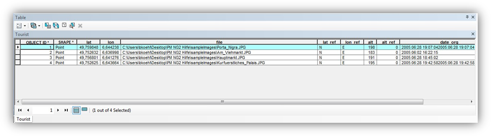
Here you can find e.g. your entries concerning the memo functions of the GPS camera, the exact position data, time of taking, number of satellites and much more.
The direction of sight is contained in the field _imgdirection. 0 means the direction of sight is north, 90 represents east. In order to make modifications, start an editing session in ArcMap. For instance, you can completely remove the direction of sight.