Update EXIF-Data in image data

The tool permits to edit and update image’s exif data. You may alter all of the information held in the exif data and then save them within the imagery. Besides, you may add non-georeferenced photos and allocate appropriate coordinates to the photo’s exif data.
If you have images of a Ricoh G800SE / G700SE / Caplio 500SE Camera the Ricoh memo content can be updated. Please note that depending on the firmware version 5 or 10 memo values are supported.
Edit EXIF data
To edit exif data, add the respective photos to your PhotoMapper project. More information on how to load data can be found in chapter “Loading the digital pictures in ArcMap”.
To modify your exif information, please start an ArcMap edit session by using the editor toolbar.

After the editing session has been started, please open the attribute table of the relevant shapefile or feature class which holds the imagery. Now you may edit the table.

You may then modify or adjust the values. Please be aware not to change the table’s structure. If you add any fields, they will not be considered in the update process of the exif data.
Once you have finished making your alterations, stop the editing session and save the changes.

If you add photos lacking spatial reference and then geo-reference them afterwards (please refer to chapter „Determine location of taking“ for more detailled information), these coordinates will automatically be written into the attribute table. When you update the pictures’ exif data, the respective coordinates are allocated to the picture.
Update EXIF Data
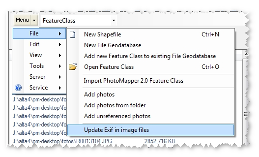
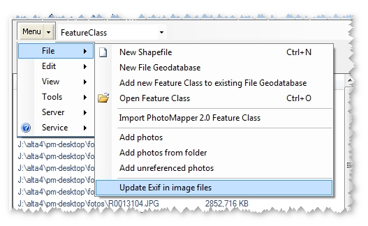
To update the modified exif data within the picture, please choose the menu „Update Exif in image files“.

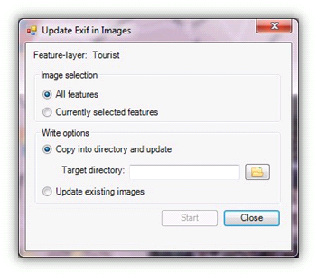
The following menu allows to control the update process of the exif information in images.

In the upper section you may select, if all or only selected pictures of the project are updated. If you choose the second option you need to select the relevant pictures beforehand.
The lower section controls the update options.
You may copy the pictures to a new directory and update the exif information. The advantage is, that the old picture are still kept and the update process is only performed for the copies. If you select this option, you have then to choose an output directory into which the pictures are copied.
Otherwise, you may update the existing images. Here, the original image files loaded into PhotoMapper will be updated.
Once all options are set, the update process may be started by clicking on “Start“.
After the update process has finished a message box appears informing if the process has been successful. The update process is then finished.

Repositioning and modifying the x- and y-values
If you change the position of a point feature via editing session and use the option to "Update EXIF in image files" the gps information within the exif header of the photos will be updated. The values will be taken from the position of the point's geometry values.
Please note that modifying the x- and y-values manually within the attribute tabel will have no effect on the update process of the exif values.