Version history
What's new in PhotoMapper Desktop 10.5?
Compatibility with ArcGIS Desktop 10.5
PhotoMapper Desktop 10.5 is now compatible with ArcGIS Desktop 10.5 and ArcGIS for Desktop 10.4.1.
What's new in PhotoMapper Desktop 10.4.1?
Compatibility with ArcGIS for Desktop 10.4.1
PhotoMapper Desktop 10.4.1 is now compatible with ArcGIS for Desktop 10.4.1
What's new in PhotoMapper Desktop 10.4?
Compatibility with ArcGIS for Desktop 10.4
PhotoMapper Desktop 10.4 is now compatible with ArcGIS for Desktop 10.4
What's new in PhotoMapper Desktop 10.3.1?
Compatibility with ArcGIS for Desktop 10.3.1
PhotoMapper Desktop 10.3.1 is now compatible with ArcGIS for Desktop 10.3.1
What's new in PhotoMapper Desktop 10.3?
Compatibility with ArcGIS for Desktop 10.3
PhotoMapper Desktop 10.3 is now compatible with ArcGIS for Desktop 10.3
Support of Ricoh G800SE
Photos and memo feature of Ricoh's G800SE is supported.
What's new in PhotoMapper Desktop 10.2.2?
Compatibility with ArcGIS for Desktop 10.2.2
PhotoMapper Desktop 10.2.2 is compatible with ArcGIS for Desktop 10.2.2.
What's new in PhotoMapper Desktop 10.2.1?
Compatibility with ArcGIS for Desktop 10.2.1
PhotoMapper Desktop 10.2.1 is now compatible with ArcGIS for Desktop 10.2.1.
Ability to sort the photos in the report in PDF format via memo value
It is possible to sort the photos within the PDF reports based on the memo values.
What's new in PhotoMapper Desktop 10.2?
Compatibility with ArcGIS for Desktop 10.2
PhotoMapper Desktop 10.2 is now compatible with ArcGIS for Desktop 10.2.
Alphabetical sorting of directories
The feature to add unreferenced photos the directories are now sorted in alphabetical ascending order if the file system allows such a sort.
Message when exceeding the path name length
If the limit of the path name length is reached the therefore the thumbnail could not be generated the user gets a message. The photo is still added to the attribute table of the photo layer but won't be exported to a pdf report.
Directional arrows for features from PhotoMapper Server Import exporting to ArcGIS for Server 10.1
Arrows can now be displayed for features from PhotoMapper Server under ArcGIS for Server 10.1.
What's new in PhotoMapper Desktop 10.1?
With PhotoMapper Desktop 10.1 the tool is adapted to newest technologies, which were implemented in ArcGis 10.1 . Furthermore there were implemented some improvements and new functions.
Especially the creation of PDF-Reports was over-worked and improved. You have now more options to style the PDF after your wishes.
Connection to PhotoMapper Server based on ArcGIS for Server 10.1
Starting with version 5.2.0 features from PhotoMapper Server based on ArcGIS for Server 10.1 can be accessed.
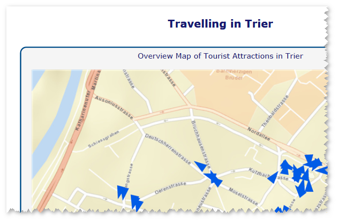
Customizable title for overview map
In the PDF report, the title for the overview map can be customized.
Save and load your PDF-Configuration
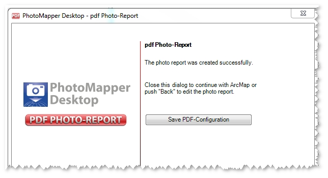
You can now save your preferences you have done for the creation of PDF photo-reports. To load this saved configuration you just start the the PDF photo-report tool. The first dialog box offers you one button to load the configuration. There you just choose the saved configuration file.
To save your PDF photo-report configuration, there is a button in the last dialog box of your PDF configuration tool.
New layout options
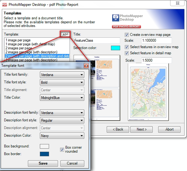
Now you have more options to customize the layout of your PDF photo-report. For example you can change the formatting options of your title and the description. Furthermore you can determine the color and the styling of the surrounding box.
With PhotoMapper Desktop you can integrate an overview and a detail map into your PDF report. Now you can also determine easily the scales of both maps within the configuration.
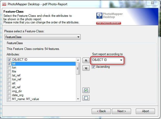
Sorting of photos in the report based on an attribute
To sort your photos in the report based on an attribute you just change the attribute in the field "Sort report according to". The default value for this field is the OBJECT ID.
Consider ArcMap Feature Selection
The selected photos in ArcMap can be used as a selection criterion. Just highlight the points in ArcMap and specify in the configuration of the photo-reports that only the selected photos to be exported.

Detection of image orientation
PhotoMapper Desktop 10.1 displays portrait photos automatically in the correct orientation.
What's new in PhotoMapper Desktop 10?
The change to the modern .net-technology is not the only thing that is new. With revised control elements, the new PhotoMapper Desktop 10 has clearly gained more clarity and usability. Besides, the developers tie up to the standard of ArcGIS 9.2 with the new data format File-Based Geodatabase.
The data management and photo handling in the Table of Content have been facilitated considerably. The photo display with MouseOver functionality and the tool control with a context menu facilitate the handling and make it more intuitive.
New user interface
The entire graphical interface has been reworked and the control elements have been simplified and reduced in number. The tool bar now only contains three elements. The program is largely controlled through windows context menus, which makes handling very simple and intuitive.
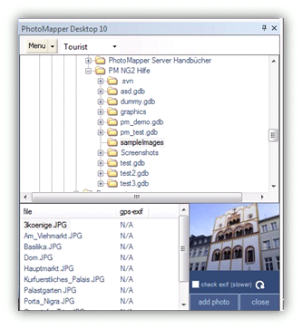
Add photos by Drag&Drop
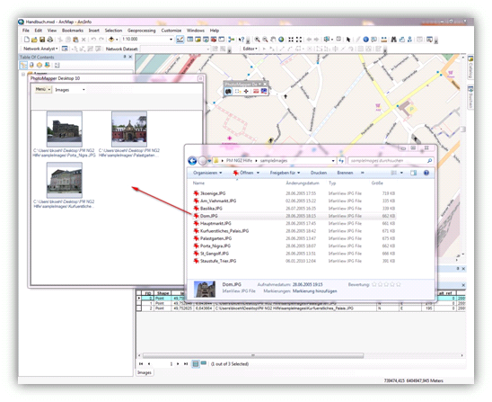
The image management in PhotoMapper Desktop 10 is automatic. Photos can simply be added to ArcMap using drag & drop. In order to do this, select the photos in any file explorer and then drag them into the Thumbnail Viewer of the PhotoMapper Desktop 10. By erasing a picture in the Thumbnail Viewer, the complete dataset is removed.
Display of the photos by mouseover function
The new MouseOver function makes working with the map even faster and more comfortable. When moving the mouse over the location of a picture in the map, the images are displayed dynamically.
Adopting attribute data selectively out of the EXIF Header
The EXIF header of a picture contains much information, not all of which is needed by every user or for every project. For the sake of clarity, PhotoMapper Desktop 10 makes it possible to select the exif tags to be adopted during the data import.

File-based Geodatabase instead of personal Geodatabase
The storage format used by PhotoMapper Desktop 10 is the File-Based Geodatabase introduced with ArcGIS 9.2. Unlike the Access-based Personal Geodatabase used up to now, the File-Based Geodatabase is set in a file structure, which means, the File-Based Geodatabase is a directory in which the data layers are saved as files.
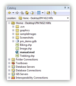
The new data format offers a higher performance, does not depend on the operating system and allows a much bigger file size than the Personal Geodatabase. Besides, it is possible to compress and encode the files. The Personal Geodatabase continues to be supported.
Adding photos to existing file-based Geodatabases
The EXIF header of a picture contains much information, not all of which is needed by every user or for every project. For the sake of clarity, the PhotoMapper Desktop 10 makes it possible to select the data fields to be adopted during the data import.
What's new in PhotoMapper Desktop 10?
PhotoMapper Desktop 10 has been structurally improved in many respects. This has led to a considerable gain in performance. Remarkable features have joined the well-known functions.
Direction indicator
Through the compass module of the Ricoh G700SE / Caplio 500 SE, there are now 2 directional values included in the EXIF area. Just like before, the direction of movement is recorded and stored in the image file. A new feature is the direction ascertained by the compass. This directional value indicated the exaction direction in which the picture was taken. Through the expanded settings, PhotoMapper Desktop 10 enables you to use the compass direction as well as the direction of moving for the images' display of direction. This is especially important when photographing with cameras which do not dispose of the compass module yet.
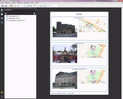
PDF Photo-Report
Through its Wizard functionality, his tool offers a comfortable and fast possibility of exporting your photos including the attributes you want to in an appealing layout as a PDF file. Through the universal character of the PDF format, the data transfer is no longer a problem.
Thumbnail Cache
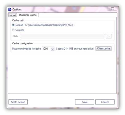
PhotoMapper Desktop 10 v. 4.1.1 introduced a thumbnail cache function for a faster access to already compiled image layers. During the import process a cache will be built which will then be accessed by PhotoMapper Desktop 10 as soon as you want to load your images again. You yourself define where the cache will be created and how much storage capacity is allocated. You may modify the settings by selecting Menu > Tools > Options > Thumbnail Cache from the menu.
GPS track import
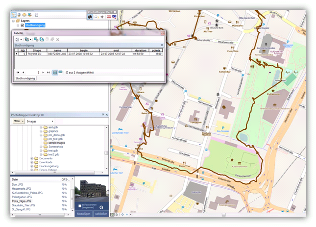
PhotoMapper Desktop 10 now offers the possibility of importing tracklogs in different formats and display them as line features. Additional import settings concerning the arrangement of the line feature facilitate later use.
Saving location information in the photos
PhotoMapper Desktop 10 allows you to locate not georeferenced photos later and write back the position inormation in the EXIF section of the photos. This location information will remain independent from the GIS layer. When sharing the photos with others, now you just need to pass the photos. The position is already included in the photo itself.
Integration of PhotoMapper Server Layer
With version 5.0.0 the possibility of integrating photos from PhotoMapper Server (v. 1.1.7 and higher) is implemented. Please also read "Integration of PhotoMapper Server layer in ArcMap"