Mapping
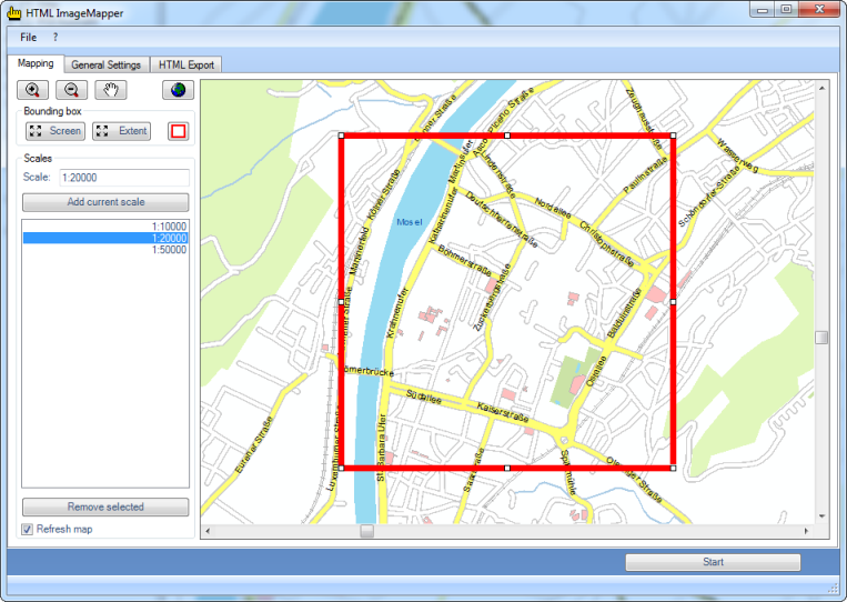
This entry mask allows you to define which part of the map shall be used and in which scales it is to be displayed. If several scales are chosen, they can be used to zoom in on the web map.

Defining the map section
The complete map can be displayed on the entire screen using the “Screen” button. The "Extent” button, on the other hand, provides the opportunity to have the entire map content of your ArcGIS project displayed.
If the two settings “Screen” and “Extend” should not be sufficient to your needs, you can adapt the red bounding box in the outline map. This bounding box displays the area processed in an HTML ImageMapper project.
Defining the scales
You can either manually enter the scales into the “Scales” input box or use the corresponding navigational functions on the outline map.
When you have found the appropriate scale, it can be added to the list via "Add current scale". After that it is possible to zoom between the listed scales in the web map.
Attention: The processing time increases significantly (to be precise: exponentially), with the number of zoom levels you export and the magnitude of the chosen scale.
To prevent the map being repainted every time you change the scale, you can disable the “Refresh map” checkbox.