When placing a tick in the "Use 'Print map' button" field, it is possible to print within the map application (e. g. as PDF). As a result, a button is added to the map application.

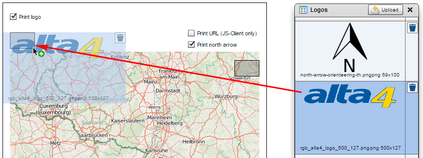
Further elements can be added to the final print product.
-
The logo: left-aligned above the map
-
A north arrow: on the top right corner of the map
If these check boxes are enabled, gray boxes are displayed as placeholders. Each of them can be filled with a graphic from the "Logos" window via drag & drop.
Several elements can also be enabled or disabled in the print product of the JavaScript client:
-
The current URL: below the map and below the legend
-
The copyright text: in the bottom left corner of the map
-
Date and time: left-aligned below the map
-
The imprint: below the legend (and below the URL, if enabled).
The copyright text as well as date and time are always printed in the Flex client. On the other side, the URL and the imprint cannot be enabled.
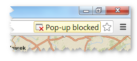
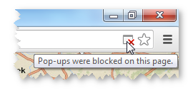
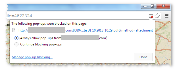
Note for printing the map (popup window)
Some browsers suppress opening a new window when using the PDF print function. This occurs, for example with the default settings of the Google Chrome (v 30.0) browser.
Please permit the browser to open popup windows.
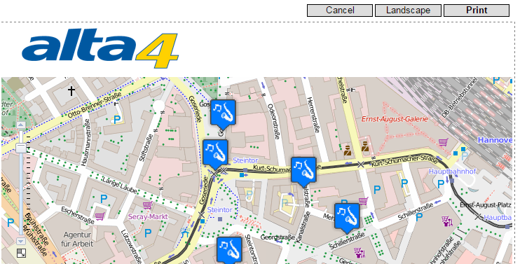
Printing within the JavaScript Client
When printing within the JavaScript client (desktop) you will be offered a preview of the print. Here you have the possibility to set the position the map for printing using the mouse. Here you can set approximately the supported DinA formats. Print jobs with different aspect ratios are printed, but may differ from the preview.
Click in the map and move it while holding the mouse button until you have the desired map extent.W ith the buttons "Landscape" and "Portrait" the layout can be changed.