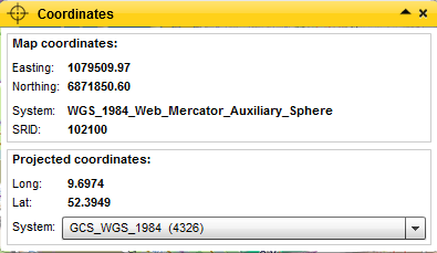
CoordinateTool

The CoordinateTool must be given a geometry service from an ArcGIS Server as base configuration. In the user interface, you have the option to later show the coordinates of the cursor position, and to have them converted automatically.