LocationFinderTool
The LocationFinderTool enables a configuration for connecting atlasFX with a tracing service named 'Location Finder'. By using this tool search items are going to be sent to the tracing service and you get apropriate search results depending on your configuration.
The results of your search with the LocationFinderTool and the one with the search of atlasFX are both displayed in your search results.
Following parameters are configurable:
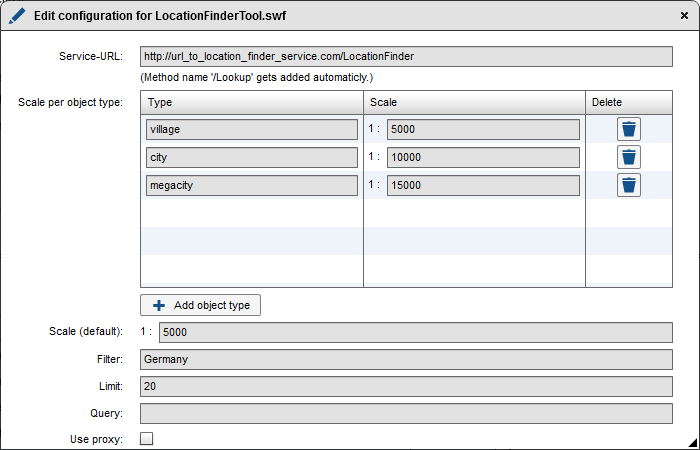
Service-URL
Enter here a service-URL of an available tracing service. The addition "/Lookup" is going to be added to your search automatically. If the service runs at the atlasFX Server a relative path can be used. Otherwise the whole URL needs to be registered. In the last case the option 'Use proxy' is required (see also 'Use proxy').
Scale per object type
It is possible to set type-specific scales which are going to be used when a result in the atlasFX search is selected. The example above shows that a scale 1:5.000 would be used by searching for a feature which matches the type 'village'. If a feature is selected which matches the type 'city' the map extent would be zoomed to the scale 1:10000.
By clicking the button  you can add a new object type, by clicking the button
  the scale which was set is going to be deleted.
Scale (default)
Here you can configurate a scale which is going to be used when a search result of the locatoinFinder search results is selected, which hasn't been configured in the segment above Scale per object type.
Filter
By using the filter it is possible to set a limitation for your results.
Use proxy
If the LocationFinder service isn't available on the atlasFX-Server it is necessary to activate the option 'Use proxy'. For using this option you have to make sure that your service is a registrated atlasFX datasource. Since a direct registration isn't possible please use the following workaround.
Workaround for a registration of the LocationFinder service:
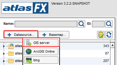
Add a GIS-Server to your datasource by clicking on 'datasource' > 'GIS-Server'
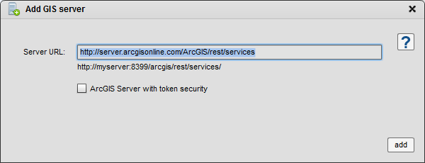
Record a random REST URL of an ArcGIS Service as a service URL which hasn't been registered at atlasFX yet.
https://server.arcgisonline.com/ArcGIS/rest/services
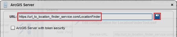
After this record is a registrated datasource please click on the button to edit the properties.

Replace the URL with the URL of the Location Finder and save your edits.